I’m home yesterday from an almost month-long road trip sojourn up and down a bunch of western states, covering some 3600+ miles in the mighty Red Dog truck, with Felix my co-pilot. By far, driving is my favorite mode of travel, especially when I can drive non-interstate roads and camp along the way.
Even in this mode, I cannot escape completely the non-place of Samerica.
You know Samerica when you are perched at the 9th traffic light in less than 15 minutes, staring at the same tailight of the same minivan, in a 4 or 6 or 8 lane boulevard with Walgreens on the left and Burger King on the right, everywhere extending plains of asphalt lawns in front of beige mega stores.
It could be Denver or Gallup or Rock Springs or Kamloops or Laramie or Billings or Spearfish or almost any city or just a town at an interstate exit. I’ve passed through Samerica in Mexico, Canada, Australia, New Zealand.
When I traveled around the US and Canada in 2011 I called it “Sametown” – this video was Montrose, Colorado
I was reminded of this non-place when Chuck Pearson blogged an epic “Maybe the Cumberland Gap just swallows you whole”. Chuck wove a powerful frame of local places.
While driving 3600 miles you have time to notice places, maybe even stop in them. I walked around small towns like like Roundup, Montana (kind of grim) and Greybull, Wyoming (about same size, but thriving). Still, somewhere on the edges of even unique towns, you find Samerica.
But I found it’s a bit more broader, I noticed its characteristics in both roads and the way I saw people get out of what might appear to be Samerica but pretty much bring it to the forests and mountains.
How I Roll on the Road
This is just how I like to travel. It’s no superior to your mode, it’s just my preference.
I avoid interstates. I had about 100 miles of this trip where I had to jump on one. It’s unavoidable.
Interstate highways are about convenience. You can go fast (I saw 80 mph limits in Wyoming). They are roads that seem to have been pulled at the ends to yank out hairpin turns, steep grades. They are predictable. Well signed. But you are limited where you can get on and off.
And they are pretty much the same where ever you go. The lack of variation is startling (I have to say the stretching I-5 in the Klamaths are pretty). But interstate highways are prime places of Samerica.
I aim for two lane highways, like US 191 in Utah. These are funky roads with personality.

Scenic US 191 flickr photo by cogdogblog shared into the public domain using Creative Commons Public Domain Dedication (CC0)
or highway 28 in Wyoming
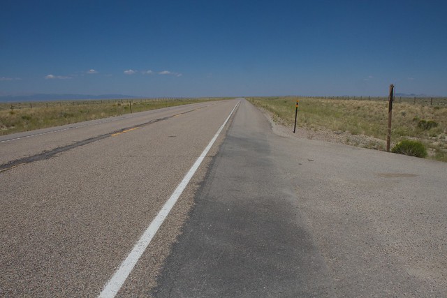
Empty Highways flickr photo by cogdogblog shared into the public domain using Creative Commons Public Domain Dedication (CC0)
or this kind in Montana where it is so quiet you can lay your belly down on the road and take the photo
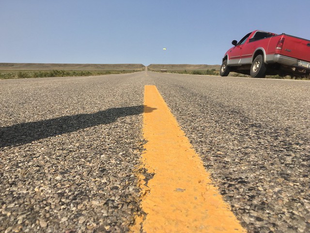
Belly on the Road US 191 flickr photo by cogdogblog shared into the public domain using Creative Commons Public Domain Dedication (CC0)
They give you subtle hints about the a steepness of grade you would never see on an I-XX
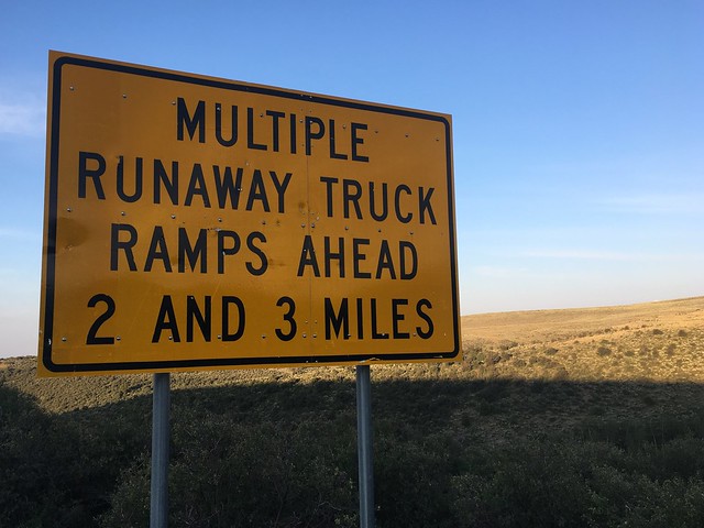
The Descent from the Uinta Mountains is Not Fooling Around flickr photo by cogdogblog shared into the public domain using Creative Commons Public Domain Dedication (CC0)
On this trip of 3600 miles my big expense was gas; I spent $458 on it. I had to spend another $70 for a tire rotation and oil change.
There might be a repair cost too; the unhelpful “Check Engine” light lit up when I was in Malta, Montana. But I was prepared; I have one of the code readers, and it came up as p0171 “system too lean” which means the fuel / air mixture is off. I called my mechanic back home, and Bob said since it was running good, that it was likely a small fuel pressure leak, but would be okay to drive home with it.
So maybe it cost more than a plane ticket, but I picked my routes, did not have to fight some stranger for an arm rest, and dealt with no surly TSA agents.
I did stay with friends and relatives for some parts of the trip, but all my travel time, this was my accommodation:
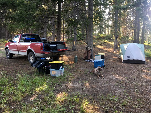
Set up for Camping flickr photo by cogdogblog shared into the public domain using Creative Commons Public Domain Dedication (CC0)
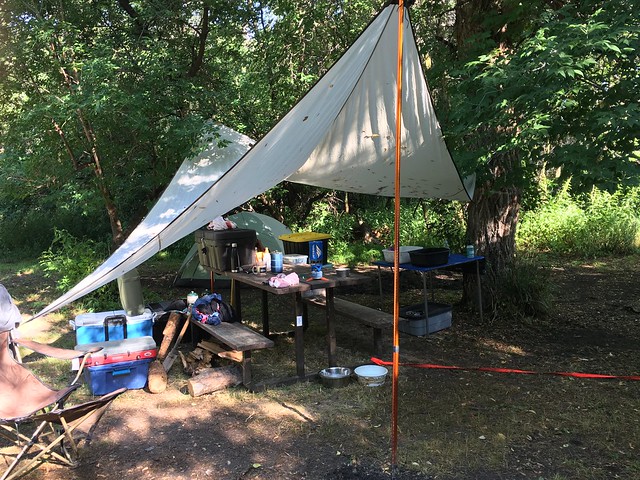
Tarping Like a King flickr photo by cogdogblog shared into the public domain using Creative Commons Public Domain Dedication (CC0)
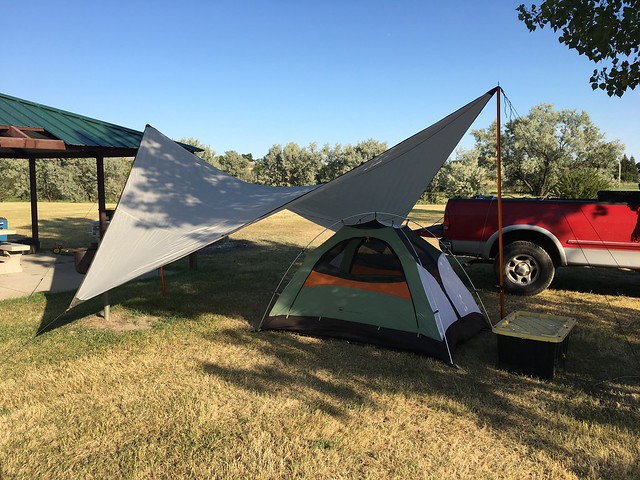
Testing the New Shade Cover flickr photo by cogdogblog shared into the public domain using Creative Commons Public Domain Dedication (CC0)
The best is dispersed camping in National Forests ($0) but a few nights I was in small town campgrounds; my total camping fees was $32.
I carry everything I need, not only the tent and tarp, but a surplus of food and water and cooking stuff. All my meals on the road were from the truck, my total food bill was $218.
Okay, I admit on the last day, with 3 hours to go, I had a mad craving for a burger and fries I got at a Burger King near Ganado, Arizona.
The regular expenses were ice for the cooler, and a lot of diet coke.
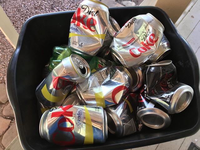
This is What Enables Day of Driving 615 Miles flickr photo by cogdogblog shared into the public domain using Creative Commons Public Domain Dedication (CC0)
And pretzels. While favorable of my Snyders hard pretzels, on this trip I became a fan of Dot’s Home Style pretzels
On Navigation
I’m admittedly a map geek. I keep next to me my 2011 road atlas, which is torn, marked up, completely annotated.
But I use a GPS too. I was against them until a trip some ten years ago to LA. The roads there baffle and intimidate me. I did not want to be looking at maps or my phone while driving, so I got a Garmin GPS.
And it worked like a charm. I use to find addresses of friend’s houses.
But here is an experiment. Try it out in places you know well. In my experience I was shaking my head at it’s choices.
I had to gaffes on this trip with the Garmin when I followed its suggestions on Forest Roads, one that tried to send me on a non-existent road, and another where the road just vanished.
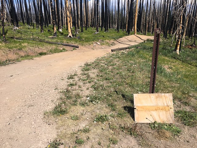
No Sign of Closed Road flickr photo by cogdogblog shared into the public domain using Creative Commons Public Domain Dedication (CC0)
I also struggle with it’s settings. If I use “Best Time” I find it sends you in routes that cut way too far east or west just to save 5 minutes. If I change to “Shortest Path” sometimes it sends you on whacky frontage roads.
I mute the sound on the Garmin, but enjoy seeing it trying to tell me to do U-turns for it’s suggestion, when I know that the better route is opposite. Coming down the west side of the Big Horn mountains, it tried to make me turn around for more than an hour for it’s stupid long route. On an interstate.
So it’s a game of knowing when to question that automatic routing. Especially when I am seeing a shorter route on the map. The Google Maps directions are often good for accounting for traffic, but I found too it sometimes skipped a route I could see was better on the map.
There were a few times I had both going, a bit whacky when one was in miles and the other in kilometers.
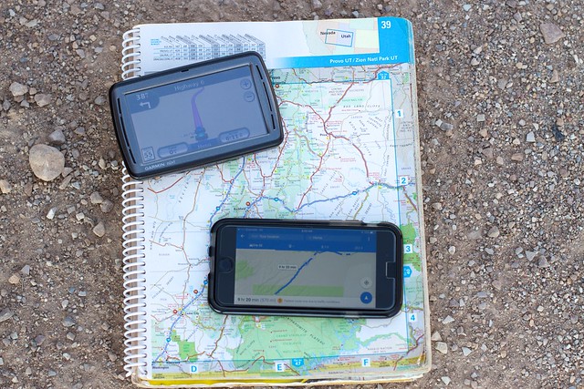
Three Forms of Way Finding flickr photo by cogdogblog shared into the public domain using Creative Commons Public Domain Dedication (CC0)
The thing with GPS directions is you never see it’s reasons. You just blindly trust because it “knows”, but armed with maps, and some critical judgment, you can be in more control. You might slap yourself a high five when you pick a better route from the map.
On Connectivity
This was no digital detox. I thrive on my connectivity, where I can get it. I thought much of my good friend Bryan Alexander’s fight for connectivity in Vermont, especially when I saw this billboard in Roosevelt, Utah
@BryanAlexander "Small Town, Gig City" is far from Ripton. Maybe you should look at Roosevelt Utah? pic.twitter.com/P08egacUot
— Alan Levine (@cogdog) July 23, 2017
Bryan gets no cellular service at his home in Ripton. For me, having a mobile connection is rather critical; as it provides a backup if your cable fails. In my home of Strawberry, AZ, I relied on a Verizon hotspot for at least a year because the local cable was poor (it got way better).
I had a few significant No Service gaps in northern New Mexico and atop the Bighorn Mountains in Wyoming. But I was surprised at so many places I got great signal- all parts of Western North Dakota, most of East and central Montana, and most of Utah and Colorado outside of narrow canyons.

Can You Hear Me? flickr photo by cogdogblog shared into the public domain using Creative Commons Public Domain Dedication (CC0)
For cellular signal, Bryan has a terrain problem. Out west you have great vast openness, long line of sight. But also, as I noticed a lot of towers. Big ones. Out in the plans I could almost always see them. Next to ranches. Atop mountains.
My first night I camped in a pretty isolated area of southern Colorado, on the north side of Wolf Creek Pass.
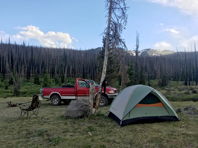
Tonight’s Set Up flickr photo by cogdogblog shared into the public domain using Creative Commons Public Domain Dedication (CC0)
I was surprised after setting up camp, when I checked my phone for the time, and saw a little bit of data. It was 1-2 bars, and did regular fluctuations from LTE to 3G to whatever 1x means to No Service.
Just enough to check email, read a few tweets, and text message. You find that social media apps like Instagram and Twitter struggle to load here, which keys in how much data they are trudging back and forth.
A similar thing happened when I camped in the Black Hills of South Dakota. I lost signal going up the mountain, but found out when I set up camp.
I was totally off the grid camping at the top of the Big Horn mountains in Wyoming.
I make do with what I have or don’t have.
I have no idea what home connectivity is in the remote spaces I drove where I got strong 4G on the mobile. But these are places with a lot less population density then Vermont. And I bet people in New England prefer not to have big hulking cell towers in sight. Outwest, they are just fixture.
You Call that Camping?
I will likely piss someone off, but to me, if you are “getting away” from Samerica by driving a house sized vehicle in the forest, running the generator and a/c all night, flushing toilets and taking hot showers… well, it’s #notcamping to me.
F***ing generators in campgrounds #thatsNotCamping
— Alan Levine (@cogdog) July 21, 2017
My peaceful spot in Wyoming was regularly interrupted by ATVs going up and down and up and down the roads. And OMG, my last night, I stupidly chose a Forest Service campground near Flaming Gorge in Utah because I was wiped out (if I had gone 10 miles up the road, I could have had peace in the Uintas).
I walked a trail to catch the sunset past a huge glob of RVs that were at most 6 feet apart from each other. The noise level was astonishing, and yet 1o minutes walk down the trail I could finally hear the birds and the wind again.
It just seems like taking Samerica into the wilderness. I guess the rationale is have these spots concentrated in a few areas, and it’s a matter of knowing how to avoid them.
On Samerica
I grew up in Samerica, in the suburbs. I lived most of my life in them, until moving full time to Strawberry in 2008. This place, and the next town of Pine, have no traces of Samerica. But I cannot avoid it. I deal with it in the closest town (Payson) to get to Home Depot or Safeway. I wade through it in Phoenix when I go to the airport.
And it serves a purpose. There is no way everyone can just walk to a corner bodega and not own a car (if you live in a big city), nor would everyone drive to a main street, park, and hit just local shops.
It has a lot to do with a car culture and where we live. It’s a mode of convenience. I don’t begrudge anyone living in the realm of Samerica, but I don’t want to, choose not to and keep my visits brief as possible.
And when I travel, I aim as much to travel around Samerica and not through it. But you cannot escape it.
That’s usually where the gas pumps are.
And the places to get pretzels and diet coke.
P.S.
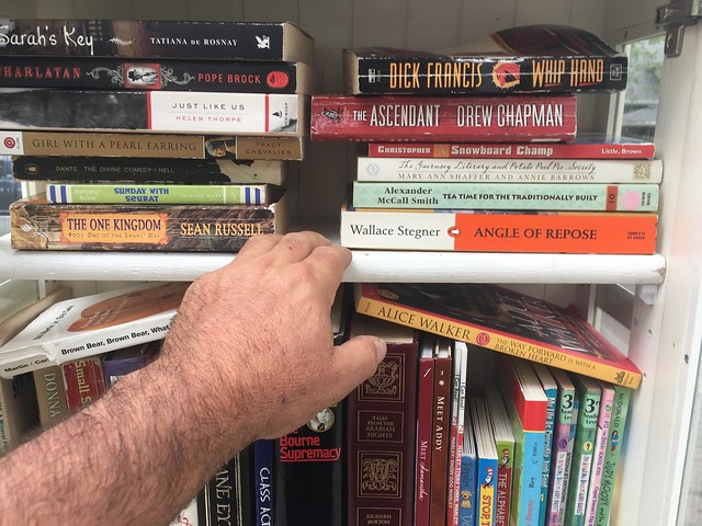
Lucky Find at a Little Free Library flickr photo by cogdogblog shared into the public domain using Creative Commons Public Domain Dedication (CC0)
A relevant passage from a book I picked in Denver during the trip from a little free library, Wallace Stegner’s Angle of Repose (1971):
It is not the Nevada City I knew as a boy. Towns are like people. Old ones have character, the new ones are interchangeable. Nevada City is in the process of changing from old to new. Up the hill, on the steep side streets, a lot of the old flavor remains in gabled houses and second-story balconies, and even the main street has an occasional old brick building with iron shutters, left over from the 1850s and 1860s. But mostly it is Main Street, Anywhere, a set used over and over in a hundred B movies, a stroboscopic image pulsing to reassure us by subliminal tricks that although we are nowhere, we are at home. All the clues are there, some in Gold Rush type: Chevron, General Electric, Electrolux. The all-seeing eye of the I.O.O.F. Weekend Specials. That Good Gulf. Ruth’s Burgers and Steaks.


It is always a Nice Time to read your stories about when you are driving Red Dog on a trip, plus this time Felix was with you.
It is too bad that everybody relies so much on Samerica because all the little mom and pop towns have their own unique personality if you have time to stay and learn it. But like you say, when you drive on The Big Roads then you always know what you will find along the way, like gas stations and places to get fuel for your vehicle.
Plus, it is a good thing to make your own campsites and hideouts. I bet Felix likes that too, because you don’t have to do stairs like in a hotel or at a two-story motel one.
Plus, as well, you can look for road signs that say 106.
Reminds me so much of my road trips round the US – just sitting on verges, getting bored of the sat nav and wanting a more fun route. My sat nav once took me down an abandoned railway line in Utah. Fun times.
Love this. I call Samerica “Anywhere, USA”